Routing new transmission lines
The routes for a transmission line project are developed in sequential phases beginning with many potential routes and narrowing to a few options. The input and feedback is used at each phase to help guide decisions about potential routes. ATC believes that the perspectives of those most familiar with the impacted areas can help improve the outcome of the routing and siting process, and lead to a better overall project that is more acceptable to those most impacted. Through the input received from the public, regulatory agencies and other stakeholders throughout the four-phase public involvement process, we consider options that are appropriate for the location and issues associated with a particular project, and consistent with routing criteria under state laws.
Transmission line routing involves trade-offs between a variety of factors. The route options that are most promising balance community input with environmental impacts, constructability, current and future land use, project costs and specific electric system needs.
At ATC we use an open and inclusive approach at four distinct phases of route development for a transmission line. (Note: Smaller projects may follow fewer than four phases)
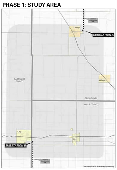
Phase 1: Study area
Once we have determined the end point areas (usually two existing or proposed substations) for a new transmission line, we begin with a study area that is usually a large geographic area from which we’ll identify potential corridors that may be suitable for a transmission line.
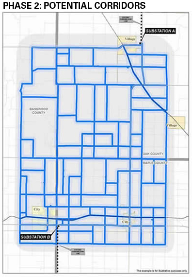
Phase 2: Potential corridors
Based on routing criteria and public input, potential corridors are identified within the study area. We generally identify several corridors (can be several hundred feed wide or more) between the end points that may be suitable for a transmission line route, but at this point the corridors have not yet been thoroughly evaluated. Potential corridors represent opportunities that warrant further evaluation and consideration.
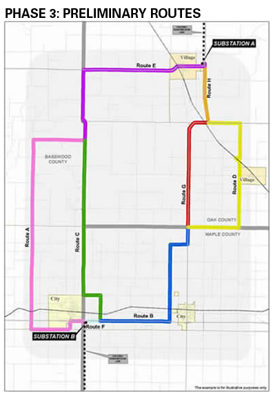
Phase 3: Preliminary route options
Based on routing criteria and public input, we move from potential corridors to preliminary route options, which are narrower in width. The preliminary routes represent those that are “still on the table” and include a more defined set of potential corridors than those introduced during Phase 2. The preliminary routes have been evaluated more thoroughly and are more likely to be considered as a proposed route.
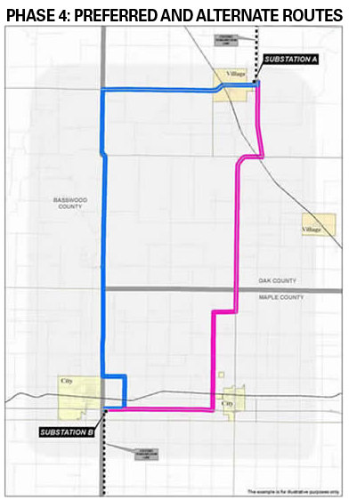
Phase 4: Proposed routes
These are the routes (two or more) that have been identified based on environmental and land use consideration, constructibility, public input and acceptance, cost, and electric system needs. These routes are formally presented in the construction application that ATC submits to the Public Service Commission of Wisconsin for authorization. ATC is required to submit at least two possible routes along with supporting environmental, engineering and construction information. We sometimes recommend a particular route which we designate as the preferred route. However, the PSC does not consider our designation in their analysis.


